My last blog from the journey itself.
In Nizwa we had to visit the fort of course.
But my true wish was to drive up to Jebel Shams as far as possible through the “Grand Canyon”.
The description we had from our book or from the internet turned out to be quite inaccurate.
You cannot drive through the Grand Canyon but rather one drives almost up to the Jebel Shams and then turn right.
The road then ends on Top of the Canyon some 1600 m higher than the start.
Also the road was marked as graded (i.e. unpaved) but was a 2 lane paved road for the most of it.
The road actually goes up to the very top of Jebel Shams, the highest mountain in Oman, but that is closed to public because there is a radar station there. There is a hike of 6 hours to reach the top (open to public). There and back 12 h. Next time.
Anyway, it was worth the drive. Very neat landscape, much cooler up there, from 45 down to 35. Next time we would probably stay in Jabal Shams Heights Resort in a tent (with heater and AC).
Here the top:


Here on the left, where it is green, an abandoned village between two walls. There even is a small lake. (see later in text to this).
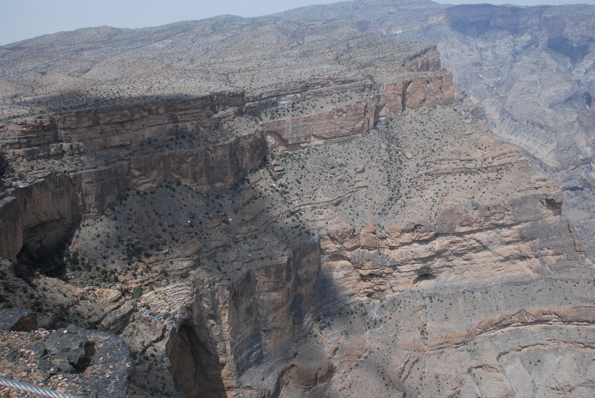
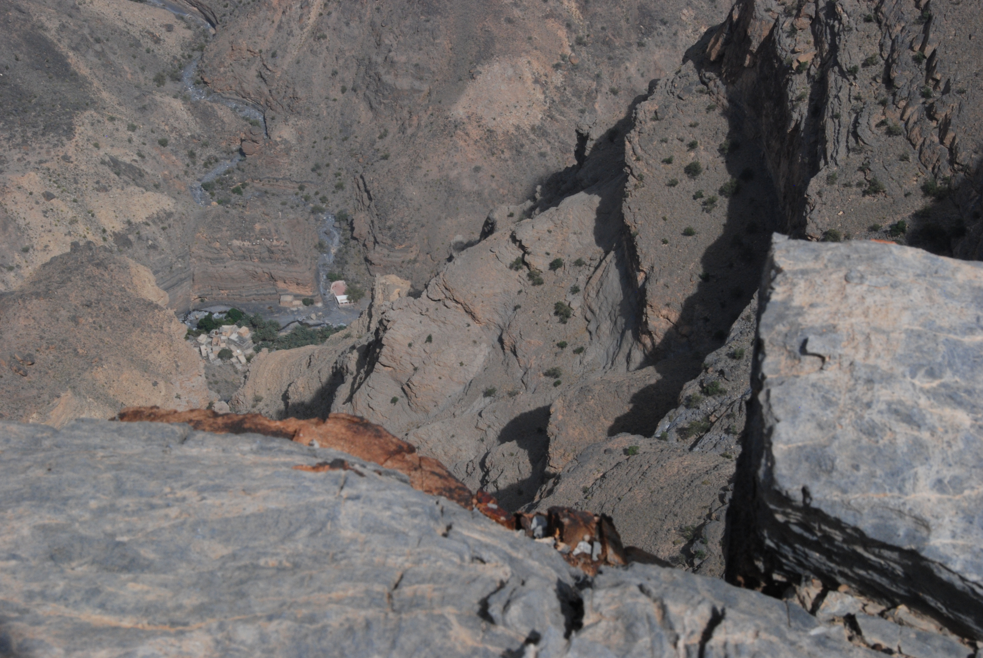
And deeeep down
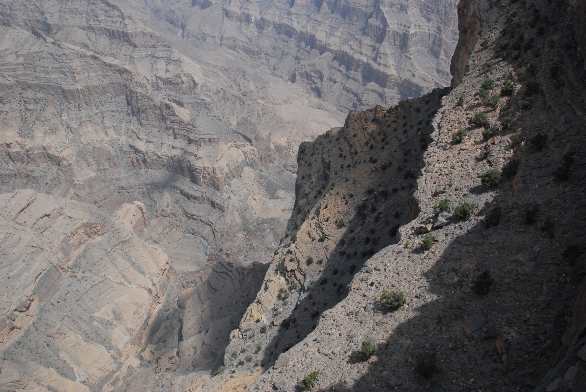
There even is a place where Nakhr can be seen, some 1200 Meters below.
There is a track from to bottom valley up there (W6a) and another one right through the canyon to that mentioned abandoned village.
That second stage (W6) we really wanna do one day. Looks awesome.
See Sketch Wadi Nakhr for details.
Back down at Ghool (see link above) we decide to give it a try and drive into that canyon from below, as there were tracks in the Wadi. Nothing on google, a good sign.
And lo and behold, I finally found the Wadi I was looking for:

and we almost got stuck. There was a right turn to leave the wadi for a road that we missed, and the drive-able part ended abruptly with a lot of loose gravel and water. The car beeped like crazy but we managed to pull free.
The road then ended after a small village.
